Saturday, July 6, 2024
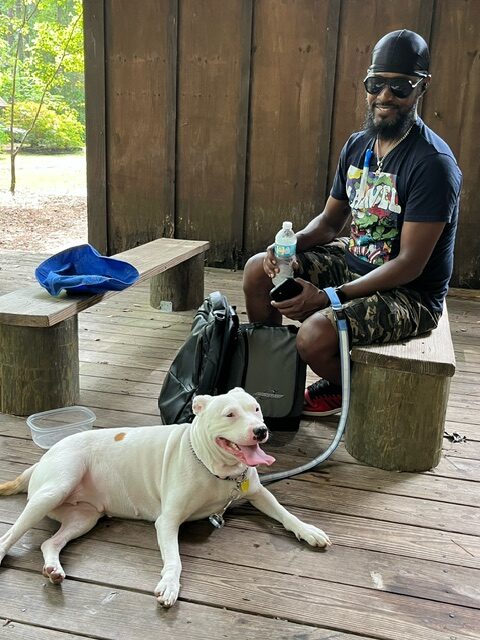
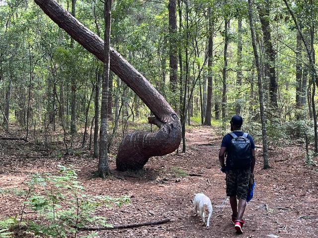
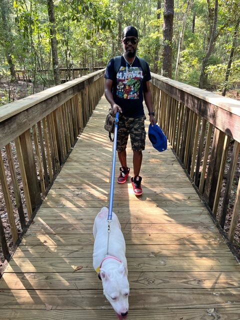
The sun was already warm when my friend Mykeal, his dog Lady, and I arrived at Tillie K. Fowler Regional Park around nine o’clock in the morning. This was Lady’s first time out on a trail and in the woods. Her whole body shook with excitement. She was crazily running around (on a leash, of course) sniffing all the new smells with a big smile on her face.
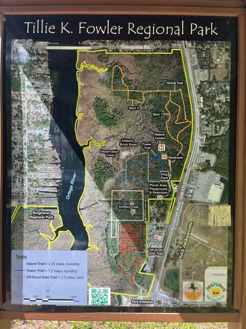
The Tower Trail
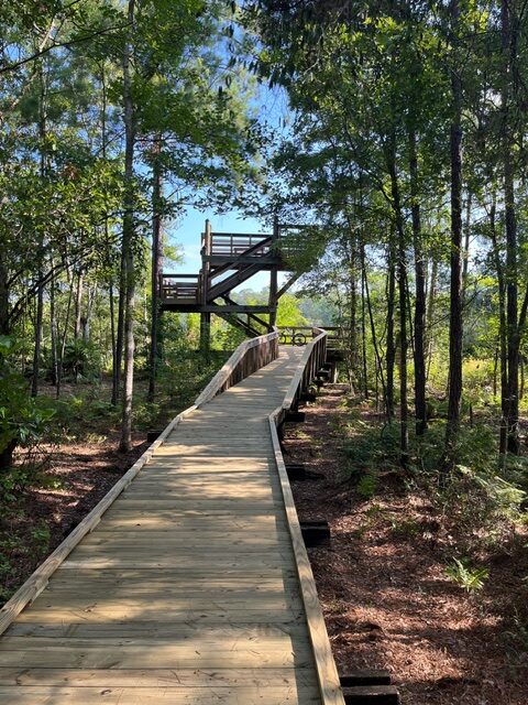
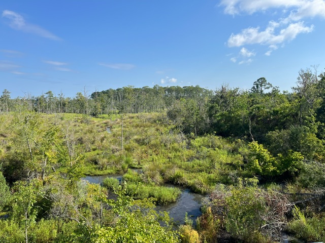
We decided to hike the Tower Trail which leads to a two-story wooden tower overlooking the wetlands on the banks of the Ortega River. The trail is flat, easy to walk, and relaxing. Many sections of the trail have a boardwalk, I assume, to keep your feet dry after big rains. According to the sign at the Nature Center, the boardwalks were completed in 2022. They still look new.
Towering trees shade the trails and boardwalks, which made for a pleasant hike, even though the sun was up and the weather was warm. One surprising thing we noticed was that no bugs were bothering us. We had brought some insect repellent, but hadn’t sprayed any on ourselves. As we hiked deeper into the woods, we were amazed that no mosquitoes, gnats, flies or any other insects were buzzing around our heads. That made for an even more enjoyable experience.
NOTE: This was our experience on this particular day. I suggest that you still bring insect repellent in case you have a different experience.
Observation Tower
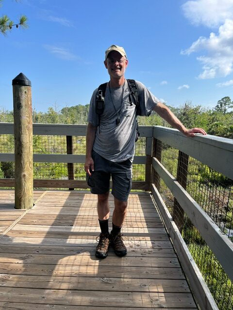
As we walked on the boardwalk approaching the observation tower, a couple with their toddler were just getting ready to leave. Lady bounded up the steps to the second floor of the tower, with us following behind her. The panoramic view of the marshy banks of the Ortega River were breathtaking, though you couldn’t actually see the river.
The observation deck was sunny and warm, but we found a small shaded area with a bench. We sat down and rested, enjoying the beautiful view.
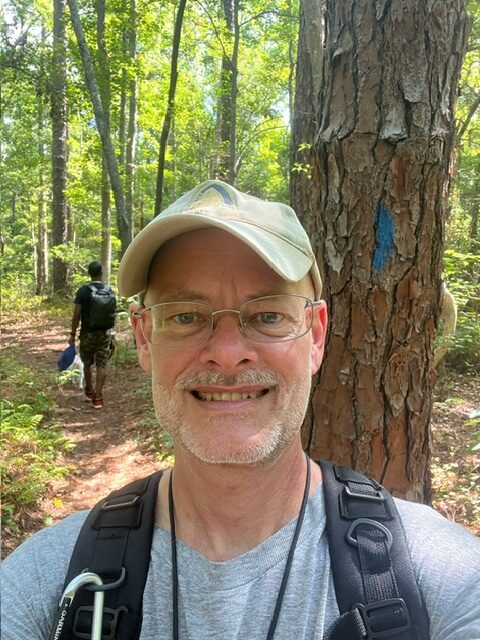
About a half hour later, a family with two young children climbed up the steps. We decided to pack up and leave. When we got to the end of the boardwalk leading from the observation tower, we took a sharp right to walk on the dirt trail through the woods. We followed the blue trail markers blazoned on the trees.
Soon we came to a wide brick road. According to the JaxParks website, this road connected Ortega to Jacksonville over 100 years ago. When you get to the brick road, turn left and follow the road a little ways until you see another trail going off the road to the right. Look for the blue trail markers.
We followed the trail to the fence surrounding the dog park. We followed the trail beside the fence and back to the Nature Center where we rested a bit and enjoyed the atmosphere. Then we got in our car and left the park.
Overall the hiking trip was easy and enjoyable. Lady had a great time. We saw few dogs and people on the trail this Saturday morning.
For more information about Tillie K. Fowler Regional State Park, see the JaxPark website.
For a map of the park, go here: https://www.jacksonville.gov/departments/parks-and-recreation/recreation-and-community-programming/docs/preservation/tillie-k-fowler-regional-park-trail-map.aspx. You can download and print out the map.
Park Information
Park Address: 7000 Roosevelt Blvd., Jacksonville, FL 32244.
Directions: Coming from downtown Jacksonville, go south on Roosevelt Blvd. Turn right on Ellyson Street, across from the entrance to Jacksonville Naval Air Station. Coming from Orange Park, go north on Roosevelt Blvd. Turn left on Ellyson Street, across from the entrance to the Jacksonville Naval Air Station.
Difficulty Level: Tower trail: Easy/Beginner
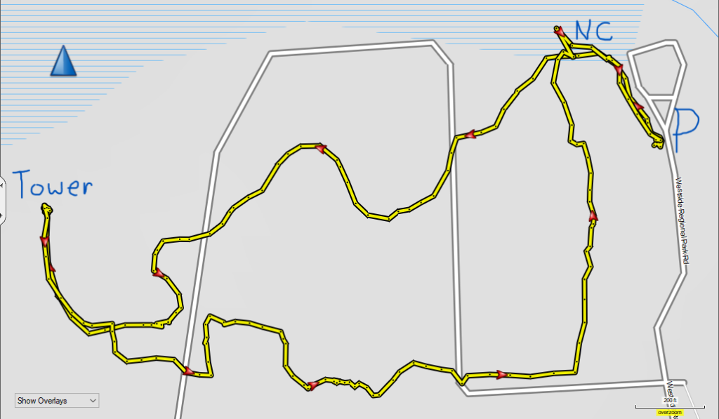
Distance: Tower Trail: 1.2 miles round trip (according to the map). 1.6 miles actual GPS.
Waypoints and GPS Coordinates:
Park Entrance: 30°13.652’N; 081°42.145’W
Parking: 30°14.280’N; 081°41.958’W
Nature Center/Tower Trailhead: 30°14.309’N; 081°42.000’W
Observation Tower: 30°14.235’N; 081°42.303’W
Map of the park:
Pictures
Some pictures of our hike on the Tower Trail at the park. Mykeal rescued his dog Lady from a friend in Michigan who neglected taking care of her, so she has a bald spot on her back that is still healing.
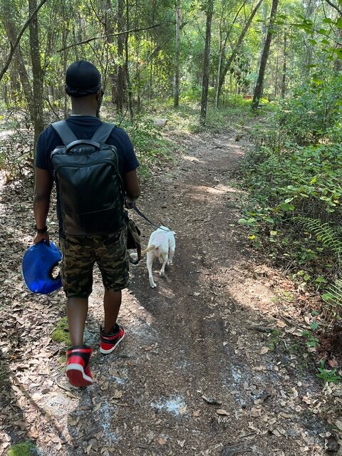
Trail